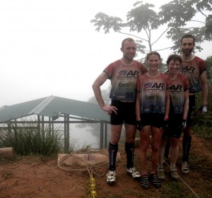
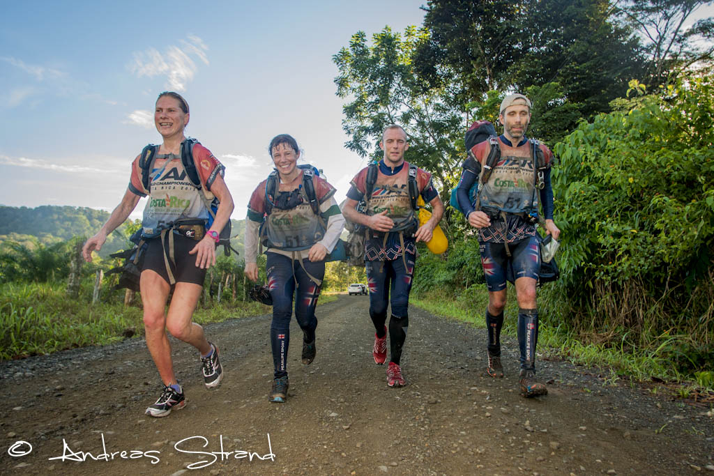
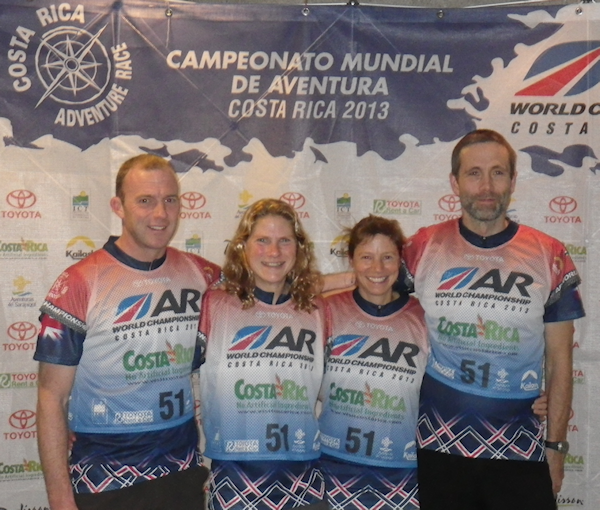
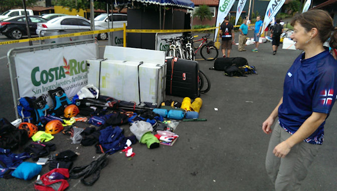
Our goals before the start
Our main aim was “to complete as much of the course as possible”. That might sound a bit vague, so first a bit of background and explanation. We knew before the start that we were going to be given a course of the very toughest caliber. We were an anglo-norwegian team put together for this event, where two members had no experience at all of adventure racing, and only one member had tried racing continually for more than a couple of days. We also knew that a relatively large proportion of the course involved paddling, and two of our members have had hardly ever paddled before, whilst the remaining two are not the strongest of paddlers. Except the all women team Ducati we were the only team not following the normal pattern of one woman (the minimum requirement) and three men. Not that we see that as a clear disadvantage – on the contrary 2 + 2 may provide better “balance” to the team, especially since the two girls does a better job with the training 😉
In this kind of adventure race there are usually so-called «cut-offs» to prevent the teams from becoming too spread out along the course. If you arrive too late at a cut-off you have to miss a section and be transported by the organisers further along the course. The team is still in the competition, but can only beat other teams that have also landed in the “short course”. The more of the course that is completed the better the ranking. Before the race, the general feeling seemed to be that few teams would manage the entire course, so we expected to end up on the “short course”.
Some teams choose to skip controls along the way, and make their own short-cuts in order to complete as much as possible of the fun parts of the course. However, we have sufficient competitive drive that this wasn’t an option for us. We wanted to complete the course we were given!
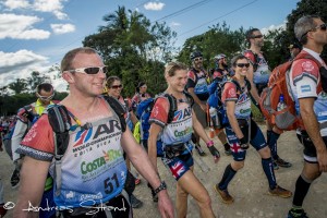
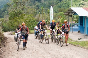
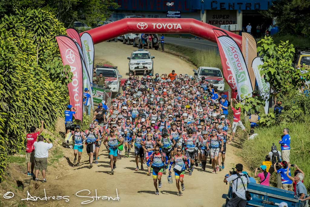
The race started in the far south, at the border with Panama. After fruit and drinks, entertainment from the local children, and a final information meeting for team captains, we walked to the starting line, full of anticipation. It was to be a Le Mans start – in other words, we would be running to our bike boxes, and would have to assemble our bikes before we could continue.
The start and first leg (cycling)
 We ran at a relaxed pace the two kilometres to our bikes, and didn’t allow ourselves to be stressed putting our bikes together – we would be racing for nine days after all! We cycled off about in the middle of the pack.
Already here at the start, we saw how the maps didn’t quite match the terrain. Luckily, there were cheering crowds at the start and we could work out from where they were standing which was the correct road to take!
The first route choice came at the first control – we had decided beforehand to take the right-hand alternative along larger roads, and had also seen an option for a short-cut across country out from the control. As we approached the control we were met by other teams coming back towards us – a different route choice than ours. But we stuck to our plan. We had some small hitches: losing drinks bottles that we had to go back to collect etc.

Our mood improved as teams much stronger than us started to catch us up – clearly we had made some good decisions so far.
Swedish Team Silva came along just as it started to get dark. That was a surprise and nice to see folk we knew. Fun too to be able to report to our two newbies that “now we’re level-pegging with the bronze medal winners from last year!” So far we had been cycling on gravel roads and tracks – not necessarily pleasant, but certainly possible to cycle. As the evening progressed the terrain became steeper and we spent more time pushing our bikes. On the way up to one of the controls it started to rain. The humidity had been high anyway, and we were sweating from our efforts. At the control, a number of teams had gathered, since there was a house offering the chance to fill our water bottles. Here we were “starstruck” again, getting quite a kick: we hadn’t expected to see Seagate so many hours into the race!
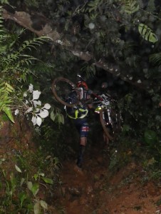 The explanation came a little later – whilst we push and shove and carry our bikes up through a slimy, muddy, narrow groove, Seagate came running past us, without their bikes. They have chosen a poorer route, but compensate by leaving their bikes and running on the path where we others are struggling enormously with our bikes. A little later we meet another team that have done the same as Seagate. We advise them in no uncertain terms to leave their bikes, but they reply “bikes are on the list of mandatory equipment”…
Five or six hundred metres of ascent, carrying our bikes through the soup of mud, was pretty exhausting. But we just have to press on – it’s the same for everybody.
Towards the end of this stage we come to a part where we can cycle again, but here we have our first navigational error – we don’t manage to keep count of the various junctions (not easy since there are many new roads that aren’t on the map), and we throw away an hour or two before we find out where we are again. At the transition to paddling, Wendy and Karl are interviewed by a SleepMonsters journalist.
Stage length: 95 km
Ascent: 850 m
Time: 16 hrs 34 mins
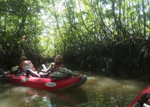
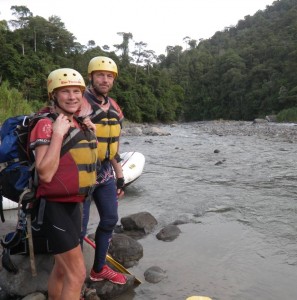
Kayak
 And so for the moment of truth – paddling: how would Karl and Chris manage, having hardly ever paddled before? Fortunately, they managed incredibly well! The inflatable “hot dogs” we had been given as kayaks were impossible to get up to speed, even for the most experienced of paddlers, and we managed to keep pretty much the same pace as the teams around us.
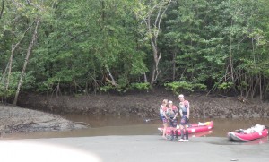
Early on this stage we came to a channel that we needed to get through, which was impossible to paddle at low tide. We were keen and creative and pulled our kayaks through the slimy mud, passing several teams who had decided to wait for the tide.
With a few hours left of the kayak leg, darkness came for the second time. So far we hadn’t slept, so when we were offered a meal and a bed at one of the controls we thankfully decided to take our first 4-5 hour rest. We spent the rest of the night completing the stage, including a rather navigationally exciting crossing of the bay, but orienteering by compass and stars went fantastically well. The stary night, phosphorescence in the water, and loads of flying fish added their magic to the journey.
Stage length: 65 km
Ascent: 0 m
Time: 22 hrs 46 mins
Trekking
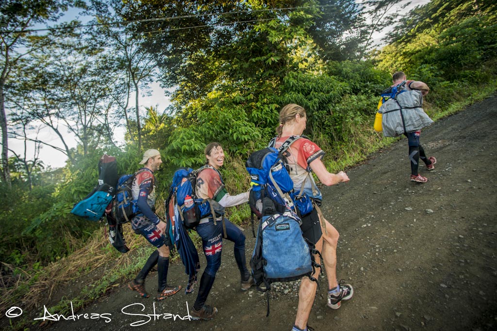
The paddling was interrupted by a trekking stage over the Osa Peninsula. The organisers transported our kayaks, but we had to carry the rest of our paddling equipment (life vests, pump, throw bags, paddles etc.). Many teams commented on the meaninglessness of this, but we were looking forward to some time on our feet and were not to be deterred.
 We ran most of the flat parts, walked quickly up the hills, and also had a successful little short-cut through the jungle, and we passed several teams on this stage. We were also good at re-distributing the load when one after the other became tired. Only Thule and Seagate were a little quicker than us on this stage. Unfortunately it was just too short a leg…
Stage length: 27 km
Ascent: 960 m
Time: 5 hrs 35 mins
Biodiversity: 2.5 % of the world’s biodiversity (on 0,00000085 % of the earth’s total surface area)
More paddling
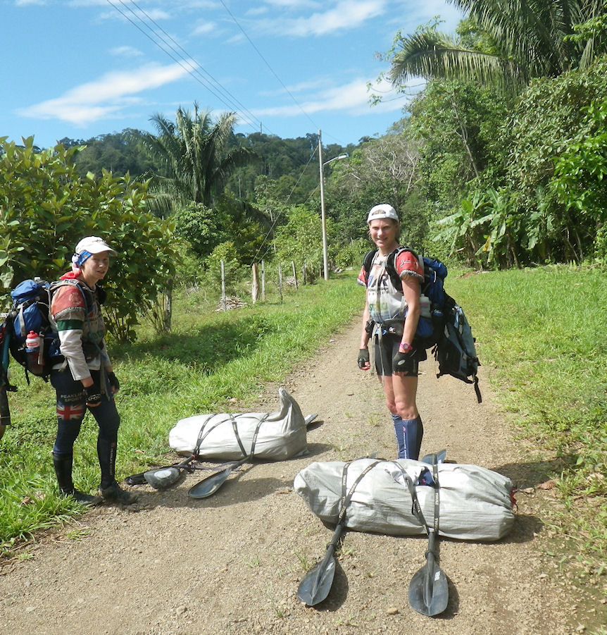
 The next paddling stage started with a portage. We had to carry our kayaks 10 km to the nearest river. The organisers hadn’t given any specifics beforehand about the surface we would be carrying over and we had decided not to buy trolleys for the kayaks. At the transition there was much discussion of whether it was better to use wheels or not, so it was alright to have no choice… After a while we hatched out what we felt was a good solution whereby we carried the boats, still deflated in their bags, on a stretcher of paddles.
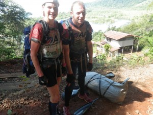
This worked pretty well, but we had to take breaks… many breaks… We had a couple of psychological setbacks when we found that paths shown on the map, which would have meant 6-7 km of portage, didn’t exist in reality, and the portage was at least 10 km, as the organisers had said. Plus an extra kilometre due to a new road that wasn’t on the map… However, the views along the way helped to keep our spirits up.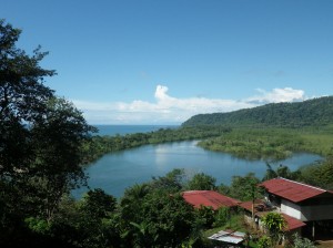
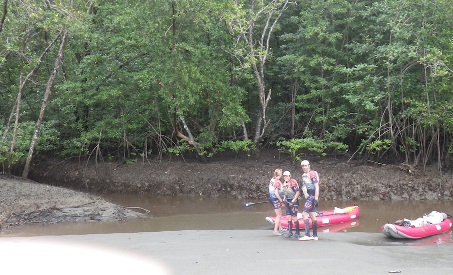
As we approached the control where we would start paddling, hopelessness nevertheless descended upon us. The map didn’t match the terrain. The control wasn’t where it was supposed to be. It was dark again, and what we wanted most of all was to lie down and go to sleep… but “luckily” we were in a terrible mosquito sump, so instead we decided to put the kayaks onto the wrong river and try to find the control by water. The rivers should meet a little further down and we could paddle back up the right river to the control.
Great was our surprise – and our relief – when we discovered the control on the bank a little further down the wrong river. Here we had the company of a dog that seemed to have fallen in love with us (or maybe he too was keen to get away from that mosquito infested hole). It was impressive how quickly he swam, and tempting – but hardly wise – to help him up into the boat, but eventually we managed to persuade him to swim to the shore, by shining our lights continually at a spot on the bank where he could climb out. The tide was on the way out and we held a good speed down the little river. After that it was just a short stretch up a bigger river then in to a control in a mangrove swamp. The low tide made the river almost impossible to navigate at night due to sandbanks and so we hauled the kayaks up to the top of a sandbank and allowed ourselves to sleep, with the rising tide as our alarm clock. This worked very well.
We found the river into the mangrove without difficulty. According to the map there should be a channel through the mangrove, and the control would be in the mouth of this channel. Deep in the mangrove the challenge began: we came to a junction where the channel split. Part way into the first branch, 3-4 other teams were queued up, resting, and told us that it was impossible to get through. Now, afterwards, it’s hard to remember the order of events… did we check the other channel first, and then stop to wait for high tide with the others… or was it the other way round?
Anyway, waiting was probably a mistake, because mangrove channels, we now know, are easiest to see at low tide, even if you have to be prepared to push the boats over branches and roots and fallen trees. When the water level is higher, it is easier to paddle, but easier to paddle everywhere, and impossible to see where the channels are.
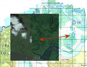 We kept meeting other teams from all directions, everybody asking each other whether they knew where they were, whether they had a plan, and everybody following everybody, but nobody found the right way, or even the way out again. When we now look at Google Earth it’s pretty easy to connect the dots and understand our predicament… indeed the dots didn’t connect – the channel on the map that seemed to lead straight to the control was not – in fact – a single channel.
Once again we were forced to take a break and sleep as we waited for the tide to turn – our strategy was to watch the currents in the water and follow the flow out. Gradually, the flow increased and we were lead back to the big channel we had come in by. At this point, some teams gave up ever finding this control. But that wasn’t for us.
We paddled out into the big river again and followed the tide out to sea, paddling around a peninsula and in to the control from the other side. Of course, our navigator rather regretted that we hadn’t chosen this route right from the start – saving 10-12 hours or so… But on the positive side, we had an absolutely fantastic – and just sufficiently exciting – paddle along the coast. Here we had to paddle through surf – both on the way out to sea and back in again. The currents and waves around small islands and rocks that were “just sufficiently exciting” in the daytime would have been pretty terrifying at night for inexperienced paddlers like us. We capsized once, without drama, in the surf on the way in towards land, but everything was tied down – except for the map folder hanging around the neck of our main navigator. Lucky we had two sets of maps…
 The control that had given us so much trouble during the night was easy to find from the other side in daytime. The next control was also in a channel in the mangroves, between two rivers. Our spirits sank as we once more came across a team waiting in a channel junction, who told us that both channels were dead ends and we couldn’t get through. But this time we were more obstinate – we chose the channel that went in the best direction and paddled straight to the control.
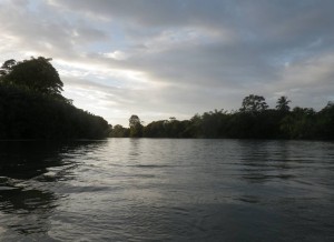
After this followed some easy controls in relatively big rivers in the mangrove delta. Here too, for the first (and only) time were we able to test our sails for half an hour. There wasn’t enough wind to make us go any faster with the sail, but at least we had a welcome break from paddling. And it was good to have rested a little, because after this we really had to put in some effort to paddle against the tide. The main navigator also had a bit of a break from map-reading since he had lost his map – good to relax a bit mentally too.
Maybe he should have rested his head even more, because as soon as he took over again, he lost focus on a rather demanding night orienteering stretch. The navigators certainly had some theories about where we were, but the consequences of paddling in the wrong direction in the maze of rivers in the mangrove delta, with tidal currents that were difficult to interpret, were just too great to take any chances. Once again we chose to sleep until daylight could help us out. However, one of us awoke early as another team passed by (making a splash that could have been a crocodile) and managed to get out of them that they were “fairly sure” they knew where they were. The rest of the team then had a very abrupt awakening as the mooring line was cut (the tide had risen and our mooring point was now deeply submerged in the crocodile-infested water), and they didn’t even have time to rub the sleep from their eyes as we paddled like maniacs after the other team.
On the way to the control, the navigator managed to get back into the map-reading and as the other team passed the control without realising it, we were able to take the lead, turn and search for the control. Wendy found it – half a metre underwater in the bushes at the river-edge (clearly some controls were hung up at low tide). The French team, who originally had seemed a bit grumpy at our following them, now couldn’t thank us enough. There was no more drama on the paddle to the finish of this stretch – just the relief of greeting daylight again: that lovely transition from night to day, as ghostly shapes become recognisable objects, the sleep monsters recede and the birds awaken. Our French friends took off from the river to take a route along the road with their kayak trolleys, but we paddled round and reached the transition before them.
Stage length: 65 km
Ascent: 190 m
Time: 44 hrs 23 mins
Cycling
The transition area was a good one, with the chance to shower, warm food to buy, and cheerful, helpful first aiders with a fantastic supply of magic creams. And although we didn’t feel that we wasted any time, we somehow managed to spend four hours here (for comparison, Seagate spent half an hour!). It is certainly possible that we could have been more efficient, but we felt that looking after our bodies – and especially our feet – seemed like a good investment of time. Later we heard that Seagate had to abort the race due to problems with their feet and although, of course, they had been through much more than us by that stage, it still emphasises the importance of taking care of yourselves.
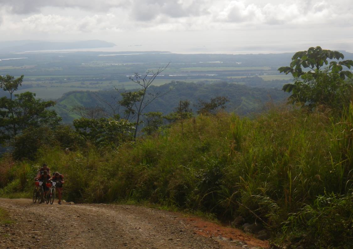
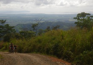 We set off on our bikes to an easy start for the first few kilometres, but came abruptly to a long, steep climb, with up to 30 % slope. We walked quickly up this, our motivation being the thought of “Superman” waiting at the top – the world’s longest, and possibly fastest zip-line.
 Unfortunately it turned out that Superman was closed when we got there, due to one of the racers having hit a tree (he had to pull out of the race, but nothing broken). Well, there was nothing we could do about that – except that Wendy and Jo Inge had the chance to go back after the competition to fly down the zip-line.
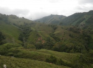
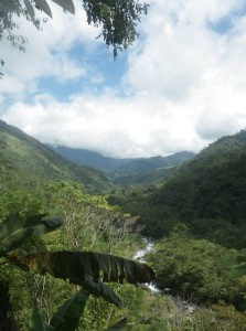
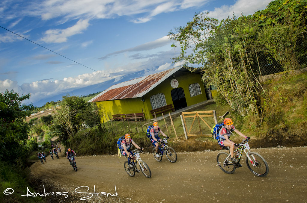
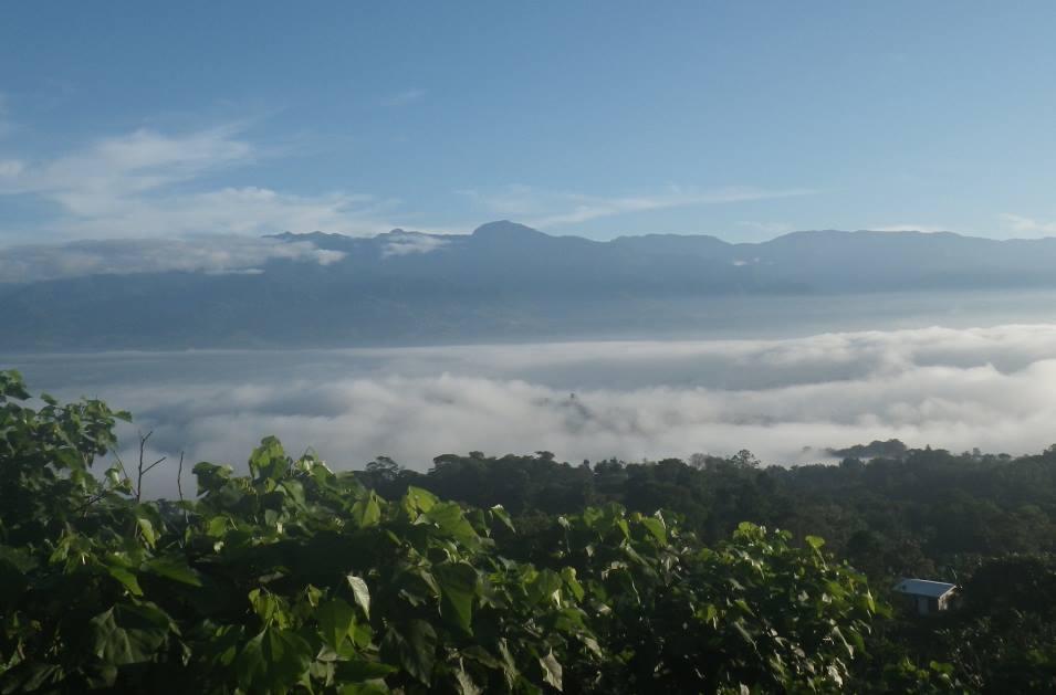
 The leg onwards was characterised by quite good gravel roads, but steep hills and we spent a fair amount of time pushing our bikes. The landscape was absolutely beautiful – incredibly green and lush, with flowers in every colour and hummingbirds to boot. That night we were allowed to sleep under a shelter in somebody’s back yard for 3-4 hours, and took an extra break to wait for daylight when we became unsure of the way towards the end of the night.
 Approaching the end of this stage, we met a gang of cheerful supporters serving water melon, bananas and coffee. What fantastic people! Normally we aren’t so keen on coffee with sugar, but here it tasted wonderful and was just what we needed to get through the last ascent up to the transition at Chirripo.
Stage length: 101 km
Ascent: 2090 m
Time: 28 hrs 27 mins
Mandatory stop and an unexpected cut-off
At this transition there was to be a four hour obligatory stop before what was announced as the toughest stage of all: a 92 km trek over Costa Rica’s highest mountain and onwards into inaccessible rainforest.
We were extremely disappointed to be told that a new cut-off had been introduced here. Originally there was to be only one cut-off along the entire course, and that two stages on from here. The explanation for why this earlier cut-off was introduced was unclear: something about bad weather on the mountain, the best teams using much longer than stipulated on this leg, and the fact that we were unlikely to make the next cut-off… None of this made much sense to us: we had been warned about bad weather and were prepared for it, and what was the point of the next cut-off if only those teams who definitely would make it were allowed through?
We were especially upset to miss this particular stage – not only did it go through interesting and exciting environments, but in addition our team was strongest at trekking (as we had proved on the first trekking section). The plan now was to bus us to the start of the rafting section and follow the rest of the course from there to the finish, i.e. dropping the trek and a short MTB section.
On the positive side, the change meant that we would probably be able to complete a greater proportion of the total distance than if we had continued on the trek and been knocked out at the next cut-off, but at the same time, this meant that the proportion of running/trekking was reduced from an already modest 17 % of the course, to just 6 %. Most of the competition would now be spent sitting on our bums on a bike or kayak, hanging on to handlebars or paddles.
Although we understand the challenges of organising such a race, which shouldn’t be planned for mid-pack racers in a World Championship, we nevertheless feel that it should be possible to make one or more cut-offs that give a better balance between the different disciplines for those who end up on the short course. We had already paddled for more than 60 hours, so a cut from the next paddling stage would have made more sense, especially considering that this was a relatively boring transport stage compared with the first two paddling stages.
Enough about that – we were nevertheless extremely quick to shake off our disappointment and start to think positively about the rest of the race. For Jo Inge it was also a nice surprise to be able to celebrate his birthday with a (somewhat soggy) candle (it had been through the mangroves…) and good light brown drink at a local “restaurant”, rather than under more makeshift conditions in the jungle…
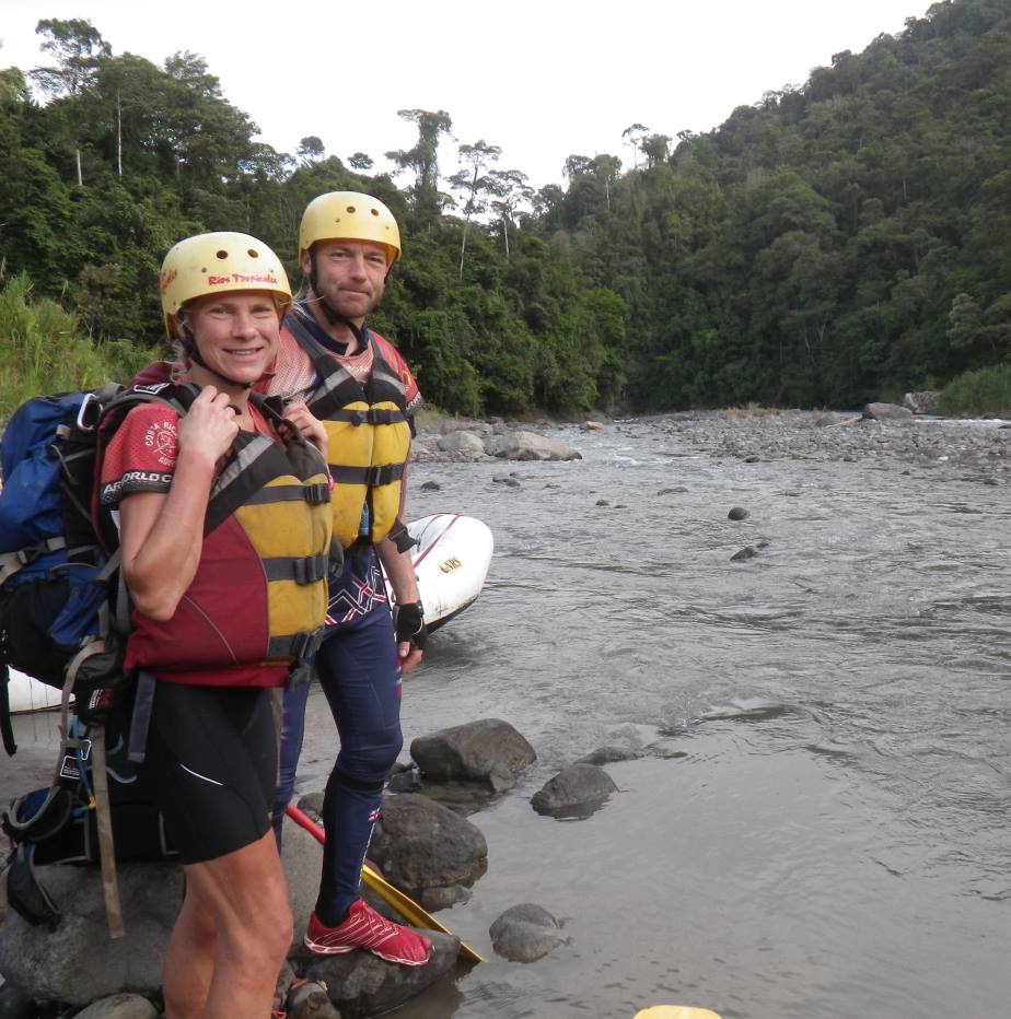
Rafting
 All 12-15 teams arriving too late at the cut-off were now in the same boat(!) as us, and were to complete the rafting as a single group.
The rafting was fun (grade 3-4 for those who know about such things), but since we had a skilled guide who gave us instructions, it was never very exciting. It would have been quite different if we had had to cope by ourselves (as Wendy experienced in France last year) , and had had to chose which line to take and steer the raft ourselves.
Stage length: 33 km
Ascent: 30 m
Time: 5 hrs 52 mins
Kayak
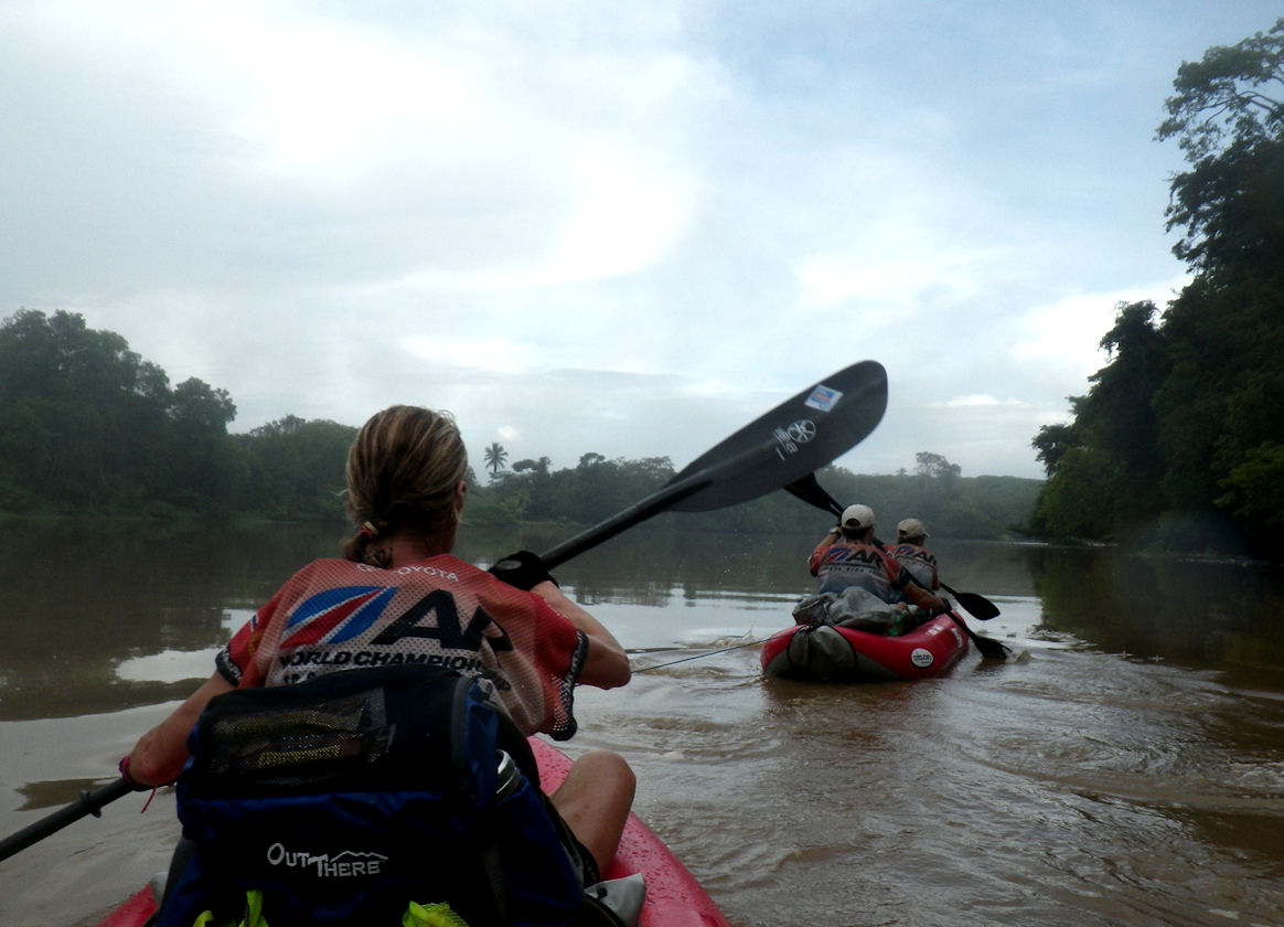
 The transition from raft to kayaks was one of our most effective, and we set off amongst the first of this group of teams we now competed against. We were a bit nervous about what awaited us now… To be honest, when we packed away the plastic “hot-dogs” we had secretly hoped never to see them again. True enough, we had made it through over 120 km of paddling earlier in the competition, but this had been interrupted by a trekking stage and a couple of involuntary sleeping breaks in the mangroves.
Now we were faced with 89 km of paddling, almost without controls, most of which was along a never-ending canal, parallel with the coast. It was pretty weird to have to leaf through four A3 maps in a scale of 1:50 000 to see the whole stretch from one control to the next. So we took it fairly easy as we paddled downstream in a river the first 37 km of the leg. On this stage we experienced one of many examples of the fantastic friendliness and generosity of the Costa Rican people (“ticos”); suddenly a couple of lads came running and wading out to our boats to deliver a large papaya into each kayak. This tasted wonderful – and was much appreciated and very touching!
We kept up a constant good speed on this stage, and again surprised ourselves, considering the lack of previous paddling experience on our team. We had a sleep for a couple of hours about mid-stage.
At dawn we came to the only control of this stage, located at a luxury lodge. When we came ashore here, we were all certain that the lodge was built on a floating wharf – after so long in our rocking boats we staggered more than we walked, and our shakiness didn’t abate in the hour that we were there. We spent some time trying to dry our hands – which looked worse than prunes – under the electric blowers in the hotel toilets. Then a friendly lady served us coffee and biscuits at a waterside table – such good coffee again!
After the stop at the lodge there was a final short stretch along a narrow channel through the jungle – fantastic! – before we could put the boats ashore and say farewell to them (there were no tears at our parting).
Stage length: 89 km
Ascent: 0 m
Time: 17 hrs 28 mins
Trekking
This short trek started on muddy paths, but we soon came to gravel roads through flat farmland. We started off running, then changed to quick walking in the somewhat hotter than pleasant sunshine, and we passed a few teams.
Etappelengde: 18 km
Stigning: 150 m
Tid: 6 t 33 min
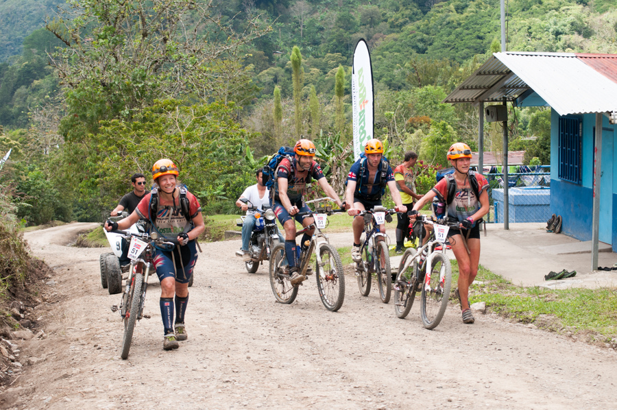
Cycling
The transition went smoothly. Strange that you can actually learn along the way in such competitions. Our only luxury here was a quick shower and a bit of attention for our feet.
We set off on the bike stage at a fairly hard pace – maybe we had forgotten that we had 156 km of cycling ahead of us. With a good, steady pace on the paddling, a quick, short trek and a quick transition, we were now quite near the front of the pack of teams that had set out together on the rafting.
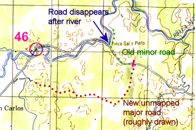
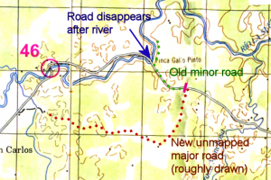 But so for a new challenge. On the way in to the first control, the road suddenly swung 90 degrees and continued south (red dotted line). At the bend, a tractor track (green dotted line) continued straight on in the right direction, but was closed by a tall gate (pink). We should without doubt follow a track westwards to the control. A team that we were catching up, however, continued on the main track, turning south. Jo Inge refused point blank to follow them in the wrong direction. He reckoned that you have to be prepared to cross gates in adventure racing, so we did just that. The tractor track continued, apparently as on the map, as far as the river. The control was supposed to be where the road crossed the river for the second time. However, our tractor track now continued in the wrong direction, northwards, and didn’t cross the river (green dotted line). We saw some bike tracks which crossed the river and tried following them, but since there were few tracks and no sign of a road onwards, there was doubt in the team as to where we were, and no mood to try following the river.
We turned around to go back to our last certain location, but met another team and decided to follow them and see what they did at the fateful 90 degree bend in the road. After some hesitation, they continued on the biggest track, in the wrong direction (south). This time we followed. The road continued in a long bend southwards, in an area of the map that had no roads, and then it became a muddy path. It was obvious from the tracks that many bikes had been this way before us. Finally we ended up at a road that could be one that was on the map – took a right turn and came in to the control from behind. Of course, it was a relief to find the control, but at the same time irritating to confirm that in some situations it is an advantage not to be able to navigate by map and compass. Jo Inge was also annoyed that he hadn’t been more self-confident and taken the team the shorter route along the river and in to the control the right way – but at the same time, it is impossible to know whether the kilometre along the river would have involved fighting our way through jungle, or whether it would have been easy going.
Unfortunately, it wasn’t long before the next navigational problem. We were now looking for a path from the road we were on, over to a road that would lead us directly north to the border with Nicaragua. First we took a path too early in a little village. Jo Inges dissatisfaction with the compass direction was confirmed by a local man who told us we were going the wrong way – that three teams had passed earlier and all had come back again. He gave us a big spiky fruit that none of us had seen before and pockets full of lemons and we went on our way, stopping soon after to eat the new fruit, which was incredibly sweet and tasted heavenly.
Back in the village we chose to ask more locals, receiving a variety of different answers. Some said we should go back three kilometres to a junction (didn’t fit at all with our map) and some said we should go on south four kilometres then take a right (which would mean going beyond the edge of our map). The only thing they agreed on was that the path we had aimed to take didn’t exist any more and wasn’t possible to follow. Jo Inge was keen to take the path anyway, considering that the locals around here probably don’t do much mountain biking, however, his confidence was shaken by the trouble with the last control so instead we followed the advice of the locals and the option that went off the edge of the map.
Out-of-map-experiences are always exciting, but considering the quality of the map, it didn’t really make all that much difference. We asked everybody we came across for “Rio Chirripo”, since the path/road we were supposed to take followed a dried riverbed with that name. Hardly anybody knew any English, and many were clearly in doubt as to what we meant, but generally waved us on. But we had heard that ticos often will do that to be polite, even if they don’t know where you are going. Eventually we met one of the few people on our whole journey who was fluent in English and when he heard that we were on our way to the Nicaraguan border, he could inform us that, yes, a couple of hundred metres further on there was a newly built, fine road that lead right to the border – it was even signposted (signposts were something we had seen very few of). Phew – saved!
Now followed a monotone and totally flat bike stretch on a rather rocky gravel road. A couple of us started to see “sleep monsters”. One of us took a nose-dive into a particularly smelly ditch, crawled up unperturbed, and was soon falling asleep again. So we took a little power-nap on a road verge – a bit longer than intended, in spite of barking dogs and an alarm clock.
Finally at the border, we were suddenly in doubt again. We came to a junction as expected, but the name on the sign didn’t match the name on the map. A few words with a team who had stopped to sleep here confirmed that they agreed that Fatima must be the same as Tigra.
The last 10 km to the control at the border were heavy going, but the growing smell of a control pulled us through. Once more, the team was in the mood for sleeping. We did have a kind of vague agreement on four hours a night, after all, and hadn’t filled our quota yet. We had hoped we might get inside a house at the border control, since it had started to drizzle, but the policeman there was of the silent type (the only tico we met on the whole journey who didn’t smile) … but after a while he directed us to a building behind the border control. This turned out to be a kind of stable – with no walls but with a roof, and a ladder leading up to a floor above the horses. Here we made ourselves cosey, and slept well to the comforting sounds of the horses below us.
When we continued on our way at dawn it was raining properly. The dirt paths were muddy and it was heavy going. There was a certain early morning grumpiness hanging over us and we went slowly. Eventually we came to civilisation, and our spirits soared with cups of coffee from the local shop. We felt far less sorry for ourselves when we saw another team who had serious bike trouble. They had broken a bike frame early in the competition, and their makeshift repair had now fallen apart. One of the team members was running, whilst another member took the broken bike over his shoulders and cycled off with it(!) Slight morning grumpiness pales into insignificance in the light of such tenacity.
Apparently, from here onwards the cycling should be OK – both in terms of navigation and road quality. In towards the last control, however, we once again have a spot of bother. We miss a turn, but fortunately are tipped off by a ranger and turn around. We find the “junction”, which in reality is a tiny path, fenced off with barbed wire. A little way along the path, just as we are crawling under the next fence of barbed wire, we meet another team on their way out. They can tell us that many teams have been searching for the control for three or four hours. Paths go in every direction, and there was no control to be found in the place where it should have been in relation to a house and a river. They were now giving up and were going to cycle around to the transition on bigger roads – we almost heard a recommendation that we might as well join them. But that wasn’t for us.
Anyway, Jo Inge was keen to get revenge over the map after the previous troubles. He fixed his eyes on the compass, followed the small paths that best fitted the map, checked terrain form, found the house, took a compass course to the river and found – just as we had been told – that there was no bridge or control at the position marked on the map… but moving to the right and 50-60 metres downriver round a bend he found the “bridge” and the control. Bingo! This was a real adrenaline kick and the rest of the stage was child’s play.
Stage length: 156 km
Ascent: 380 m
Time: 25 hrs 36 mins
Canopy tour and rafting
In many respects, the competition was now over, but first a “canopy tour” with five zip-lines (where you slide along a wire suspended between trees and over valleys or rivers) – fun, but not quite “Superman” (the one we had missed earlier in the competition).
Finally, a rafting stretch: this one on a much gentler river than the first, and we slide peacefully along, paddling every now and then. The great thing about this part is our guide. Not only is he a former Olympic participant in kayak slalom (in the Barcelona Olympics), but he is also extremely knowledgeable about the plant and animal life along the river. He can answer all our questions about everything we have seen earlier in the race, whether it be birds, animals, the habits of crocodiles, or which unknown fruits we have been receiving from ticos along the way.
Stage length: 18 km
Ascent: 0 m
Time: 3 hrs 24 mins
The finish
There are plenty of people around the finish, and it is great to cross the finish line to applause and cheering, and to be met by the organisers with big bottles of good, cold, brown liquid. There is a certain dampness in the corners of the eyes. Oh how wonderful to have reached the finish and accomplished our goals! Even though, thinking back, we never felt that we were anywhere near giving up, and we never had any major problems, it is nevertheless no mean feat. We see that many teams have been forced – or have chosen – to pull out, both top teams and less experienced ones. A number of teams have also given up on some of the difficult controls.
We also see that it’s a long way up to the top teams. We respect them greatly and are deeply impressed. And we see that we have plenty of room for improvement: with more experience and training at the things we are weakest on, maybe we can have realistic ambitions for a better result next time (mind you, our result wasn’t too bad either: number 36 of 60 starting teams, best and only Norwegian team… and – always interesting for Norwegians – no Swedes in front of us… although of course we are really sorry for Silva and Axa who were forced to withdraw due to accident and illness).
A few keywords for improving our performance would be: more efficient transitions, fewer and shorter breaks and a bit less sleeping. We can also improve our strategy when faced with navigational challenges, but we see that we are not the only team who has struggled with unusually poor maps.
For this race, we had our goals and made our plans in relation to them, and we succeeded! We have had the journey of a lifetime through a wonderful country and we thank the organisers from the bottom of our hearts for giving us this opportunity. Pura Vida!
—-
We would like to thank family an friends for encouragement and support, employers for their flexibility, and our partners:
Trimtex: Your race wear design emphasized our anglo-norwegian cooperation perfecly, and the quality was excellent. As an example Jo Inge admits that he did not change his triathlon shorts during the whole race, and no sore butt after more than 600 km paddling and biking is impressive.
Sportsmaster: You made it a lot more likely that we would be able to complete 220 km paddling. The paddling machine will be used frequently during the winter, and hopefully we can enter the next season without paddling as our Achilles’ heel.
Windpaddle: Unfortunately there was hardly any wind during the whole race, but during a half an hour period we experienced how the sails could (and in the future can) save us valuable energy on long paddling stages.
Petzl (from varri.no): Your multisport helmets are very lightweight and can be used for climbing, whitewater paddling as well as cycling, and provides easy mounting of our Petzl torches (and other torches for that matter). Therfore we chose to use them also on the long cycling legs rather than ordinary cycling helmets.


 English
 Norsk
Norsk 


